scandic havet - roast
the Arctic Ocean | Jan Mayen
Way far out in the Arctic Ocean there is a small isolated Norwegian island called Jan Mayen. It is situated around 500km from Greenland and 1000km from the Norwegian mainland. The island is administrated of the county governor of Nordland and only 18 inhabits with a 6 month rotation staff the island at all time.
The only way to reach Jan Mayen is either by boat or plane, but is very limited, making it an exotic place few people ever will experience.
Camp Margareth
Credits: Hugo Øien
Jan Mayen has a brief history with whaling activity in the 1600s which lasted
for around 50 years and the island was rarely visited after. A new era started
up in the end of the 1800s when an Austrian science expedition found place,
mapping the island.
In the early 1900s Norwegian trappers arrived the island hunting arctic
fox. A meteorological station was established and the island became a part of
Norway in 1930.
Camp Margareth was build in 1929 by the manager of the meteorological station,
Fritz Øien, along with other staff members. Named after his wife Margareth,
this trappers hut supplied as shelter while hunting far away form the station.
Ishavstimen
Fog rolling over the smallest point of the island. While standing on the ground at sea-level the view can be totally different. Depending on the height you cant even see the top of the volcano, which actually is a rare sight at summer time due to the fog.
Days like this its usually not tempting to run out in the mountains, but you never know,
you might get stuck or you might get lucky.
hercules
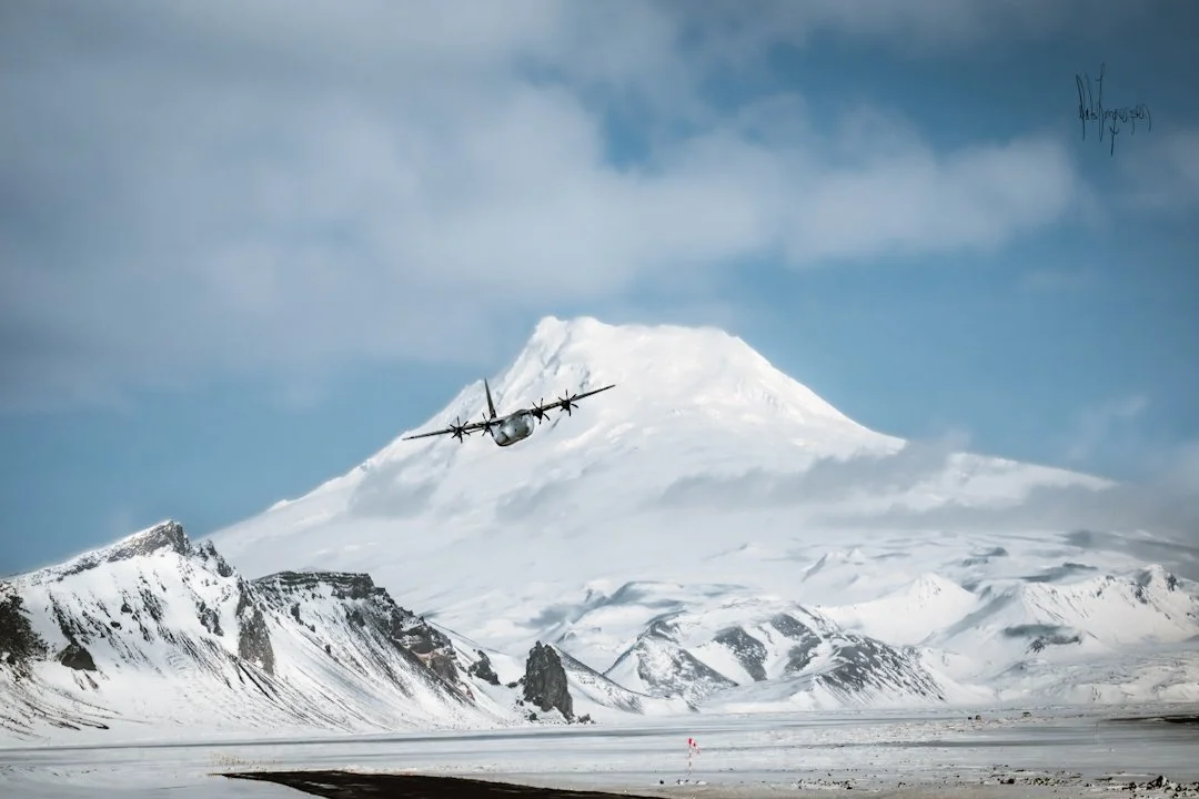
The most efficient way to arrive the island is most definitely by aircraft, but far from easy.
Jan Mayensfield (runway) is primarily used by the Norwegian army and their
C130J Hercules, besides from the ambulance-planes in emergency cases.
No commercial or civilian flights. The weather, primary the fog can make it challenging to land on the island and it can go weeks between good flight weather.
Due to the volcano, kármán gusts can occur if the condition is right, making the wind
change directions.
sunset|sunrise
In the summer months the sun is visible at all day and night besides when its hidden behind the volcano, Beerenberg. This photo is taken at five in the morning after spending the whole night at the tallest peak at the south of the island.
In frame is Mt.Beerenberg rising 2277 meters above sea-level covered by glacier. It is the world’s northernmost active volcano and is the most dominant part of the island.
The peak of the volcano is named Haakon VII top and is often reached by the crew on the island
and other expeditions arriving with boat.
altocumulus lenticularis
Clouds like this can occur when fast moving wind in the same altitude as a curved mountain is forced up over the topographic barrier. This creates a a downwind and pushes it around the
mountain making these special lens clouds. They typically occur on volcanic islands.


